High resolution seismic reflection
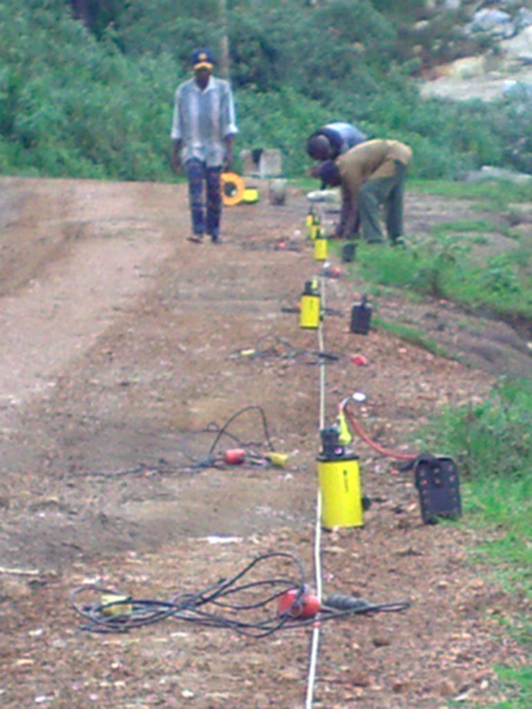
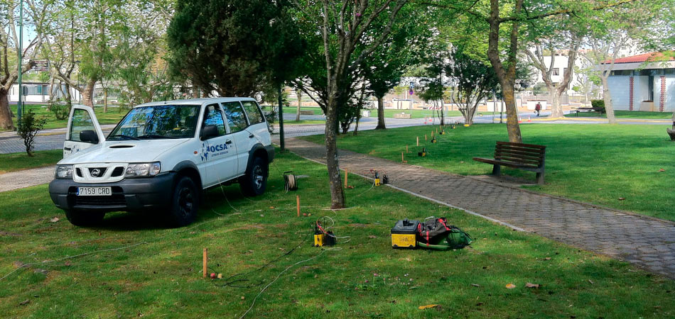
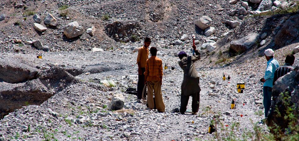

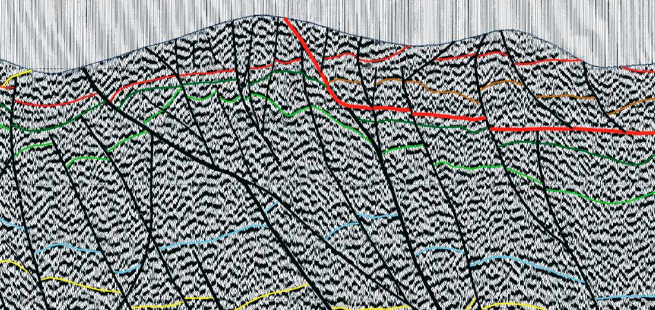
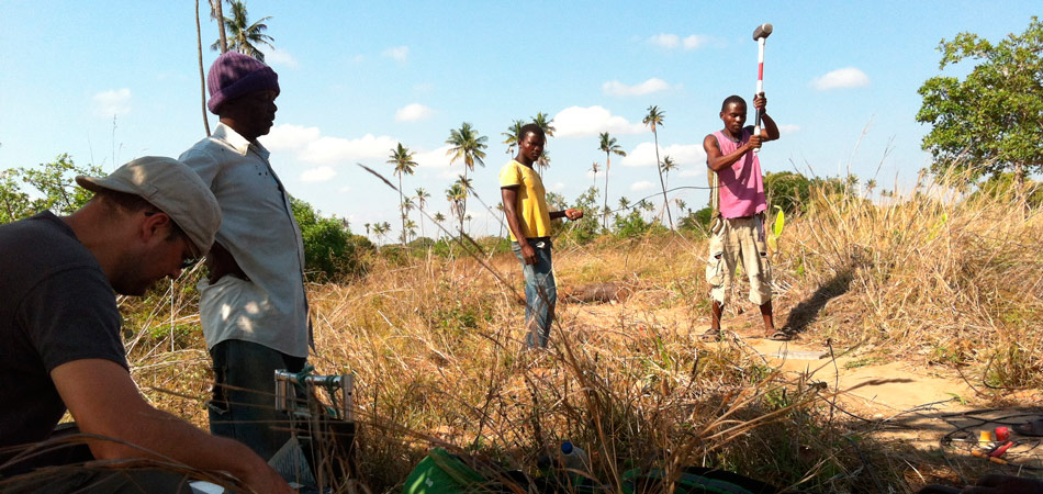
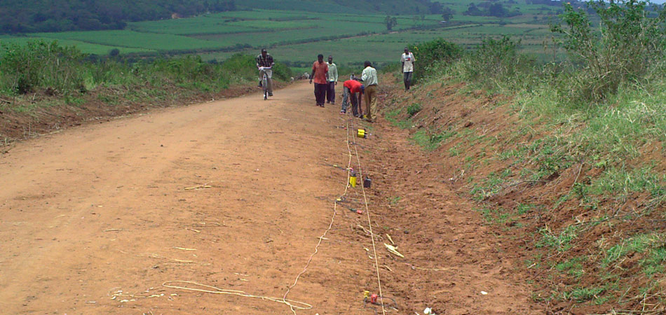

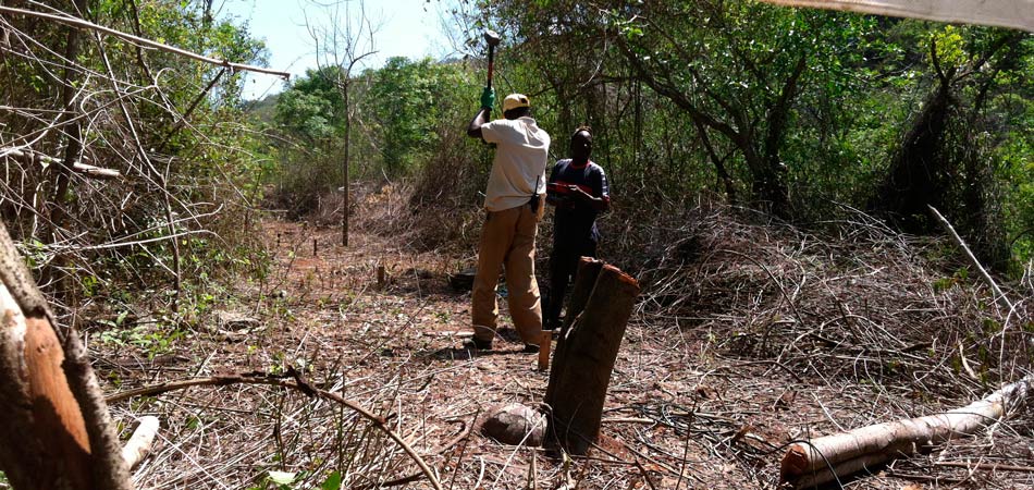
One of our main geophysical services is the high resolution reflection seismic applied to geotechnical and hydrogeological studies. This geophysical technique is one of the most powerful tools for the study of geological formations in the first 700 - 1000 meters depth (adjusting the device and choosing a source of Adequate energy could be reached up to 2000 m depth).
Basically, the seismic method of reflection consists of generating a seismic wave train, using an appropriate energy source (hammer, "gun", weight drop, dynamite, etc.) and measure the travel time of said waves, once Reflected in the different layers or interfaces with sufficient acoustic impedance contrast (velocity * density), between the energy source and a series of sensors (geophones), arranged in a straight line from it (profile).
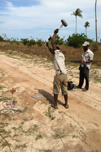
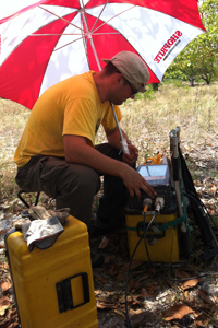
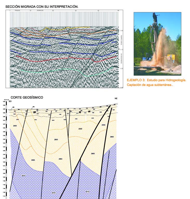
The reflection seismic allows the reconstruction of the trajectories of the primary seismic waves. Defined by precise knowledge of both seismic velocity and time traveled on the ground. From these it is possible to delineate the structural arrangement of the different seismic horizons along the profile. Obtaining high definition geoseismic sections, as shown in the attached examples.
These geophysical method is sensitive to changes in acoustic impedance in depth, whether positive or negative (increase or decrease, respectively, velocity with depth).
The generation / transmission of seismic waves has associated other types of unwanted waves, caused by surface conditions, random noise, multiple reflections, etc., which are recorded at the same time as the primary waves, but that today's techniques Allow for considerable attenuation by means of a multichannel record.
The use of this geophysical technique, associated to the data provided by some boreholes and a geological map, provides a clear structural view of the subsoil for civil engineering works. With an overall lower cost of projects.
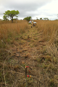
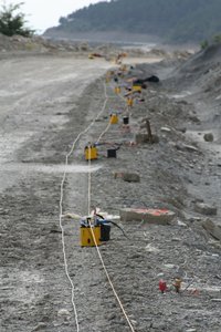
Our work system (multi-channel recording system) for this geophysical technique allows us to add different seismic traces with a common subsurface reflection. Starting from a technique of field registration, denominated C.D.P. (Common Depth Point). The degree of coverage that is achieved and the wide range of geophone-energy distances used when stacking and processing adequately provide effective attenuation of random noise and non-primary reflections. This provides a more reliable interpretation, due to a marked improvement of the signal / noise ratio.
Since our geophysical services are mainly focused on the study of the geotechnical or engineering part of the terrain, ie relatively shallow areas. This technique has been adapted from the oil seismic, studying the most superficial layers of the terrain, by means of an exquisite field data acquisition methodology, in terms of the selection of acquisition and registration parameters, degree of coverage (minimum 2400%), and horizontal resolutions Small (on the order of 1.25 meters).
Likewise, later in the office work, it is necessary to perform a process similar to that used in oil studies. But suitable for the treatment of the first record second, usually. For that it is essential to use powerful processing programs (oil seismic programs adapted to the time of registration used) since the variety and power of the mathematical algorithms that they use allow to obtain a good final results (sections stack and migrated).
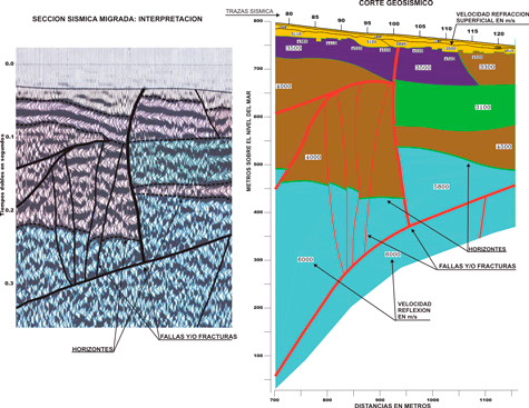
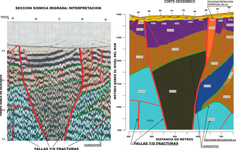
This processing requires at least the following steps:
- Demultiplexed
- Editing bad traces
- Amplitude recovery
- Mute
- Use of various filters (bandpass, F-k, etc.) Bandpass filter
- F-k filter (frequency domain)
- Collection of mirror reflection points
- dynamic equalization
- Deconvolution (various algorithms) D.A.S.)
- Static corrections terrain
- Speed Analysis (fundamental several algorithms)
- Residual static corrections
- Dynamic Corrections
- Multiple coverage sum
- Random noise attenuation
- Static corrections to the reference plane
- Migration (fundamental several mathematical algorithms)
- Variable filter, etc..
- dynamic equalization
After obtaining the stack section , the structural interpretation is performed on the migrated section . To do this, it is essential to define the velocity field in order to obtain a correct transformation of the time-to-depth sections and thus obtain the corresponding geo-seismic section with the definition of the layer velocities. All these processes require the obtaining of static corrections of high resolution, without which the sum of signals will not be adequate.
high-resolution reflection seismic applications
Our reflective seismic services are used in geotechnical or civil engineering for tunnel projects, dams, deep foundations, important landslides, etc. Providing structural data of the terrain as the definition of the network of faults and fractures, arrangement of the different existing lithologies, valuation of the Barton Q index, etc.
The use of this technique in hydrogeology allows the location of aquifers, fracturing systems in impermeable formations through which water can circulate, etc. Being also a perfect tool for the study of geothermal systems, in the study of hydrothermal diffusions.
Also the structural studies of areas with possible mineral or existing deposits provide a global vision in mining.
Examples of high resolution reflection seismic
Study of the hydraulic tunnel layout with reflection seismic
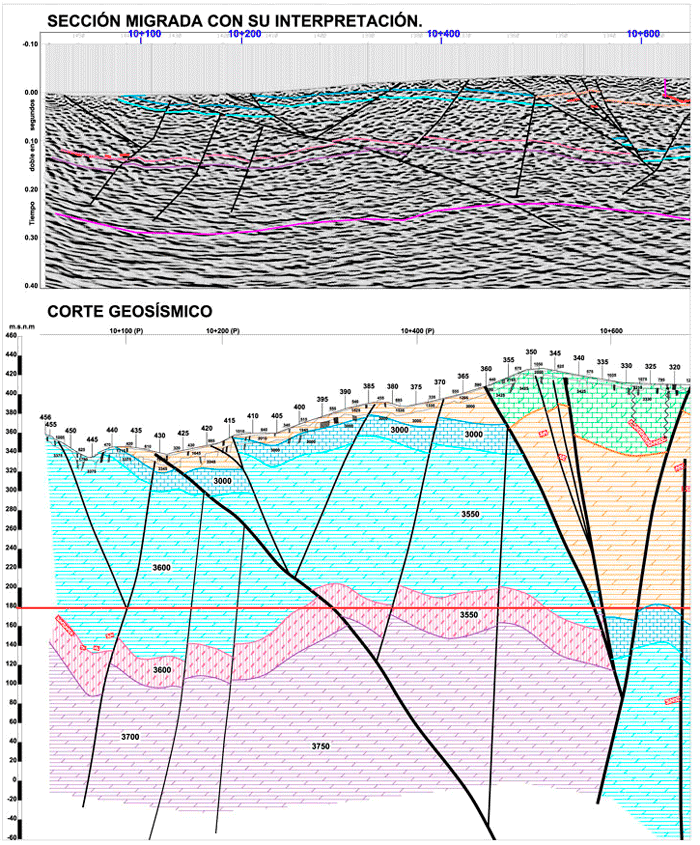
Project layout of a railway tunnel through seismic reflection
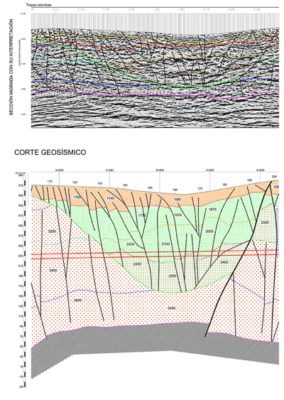
Use of reflection seismic for hydrogeology